|
| |
Southern Trails
- The Paiute ATV Trail
- Probably the best organized ATV trail system in the country.
Friendly townspeople, great riding, and fantastic scenery.
Main loop is 275 miles, with all the spurs it's almost 2000 miles.
There are 2 ATV Jamborees held every year....
- Contact for trail maps & info :
Marysvale Chamber Of Commerce
P.O. Box 126 Marysvale, Utah 84750
(435) 326-4231
or
Sevier Travel Council
220 North 600 West
Richfield, Utah 84701
(800) 662-8898
-
- Canyon Of Gold Ridding
Tour
- West of Marysvale Utah, the mouth of Utah's "Canyon of Gold"
stretches before you. From at least 1865, flecks of gold in
the creek and veins of gold inside her walls have drawn the hopeful
to this canyon by the thousands.
-
- Canyon Rims Recreation Area
- Canyon Rims Recreation Area is an immense, diverse region located
between the southeastern Utah towns of Monticello and Moab. Within
this vast area, visitors may tour scenic overlooks by automobile,
camp, explore off-highway vehicle (OHV) trails, hike, backpack,
ride bikes and rock climb.
Contact for more info:
BLM, Grand Resource Area
885 South Sand Flats Road, Moab, UT 84532
(435) 259-8193
BLM, San Juan Resource Area
P.O. Box 7 (435 N. Main) Monticello., UT 84535
(435) 587-2141
Canyonlands Natural History Association
30 S. 100 East, Moab, UT 84532
(435) 259-6003
Moab Information Center, Center and Main Streets, Moab, UT 84532-
- Coral Pink Sand Dunes State Park
- Twelve miles(435) 587-2141
Canyonlands Natural History Association
30 S. 100 East, Moab, UT 84532
(435) 259-6003
Moab Information Center, Center and Main Streets, Moab, UT 84532-
- Coral Pink Sand Dunes State Park
- Twelve miles off U.S. Highway 89 near Kanab, lies the wide-sweeping
expanse of Coral Pink Sand Dunes State Park. It is a wonderful place
for riding off-highway vehicles, taking photographs or just playing
in the sand. The park has a 22 unit pull-through campground, modern
rest rooms, showers, waste disposal station and blacktop roads.
-
- Casto Canyon Trail
- Beginning at the Casto Canyon trailhead the trail takes you
into a wonderful world of red hoodoos, sandstone cliffs of white,
pink and even green colors. The spectacular red rock is evident
along most of the Casto canyon ride until you reach the forested
areas of ponderosa pines where the colors changes with every turn
of the trail.
-
- Fremont
ATV Trail
- This trail is 50 miles in length, beginning on the north in
Circleville and concluding at Tropic Reservoir on the south.
-
-
Paunsaugunt ATV Trail
- This trail is located on the Powell Ranger District of the Dixie
National Forest. There are several trailheads that take you into
this spectacular area of pines and red rock views. On the north
end the Tropic Reservoir trailhead is your access point. On the
southeast access is from the Crawford Pass trailhead. At the south
end the Straight Canyon trailhead is the access point. There are
over 76 miles of trails to discover, with an additional 25-30 miles
of access roads which can be used by ATV's and four-wheel drive
vehicles.
- Poison Creek Trail
- The Poison Creek OHV Route is located in the Escalante District
of the Dixie National Forest just southeast of Antimony on the John’s
Valley Road; Highway 22 will take you south to Highway 12 & 63,
the Bryce Canyon National Park intersection.
-
- Garfield County
Trail Map
-
- La Sal Mountains
- The Manti-La Sal National Forest punctuates the scenic wonders
of southeastern Utah. The three separate mountain blocks provide
islands of green rising above the desert. Here visitors can find
adventure, romance, and unparalleled scenery.
-
|
|
|
| |
 |
|
|
| |
|
|
| |
 |
|
| |
 |
|
| |
 |
|
| |
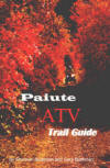
NEW "Paiute
ATV Trail Guide Book". Page
after page of detailed information on the Paiute
ATV Trails. Photos, Maps, GPS Data for every
intersection and point of interest on the trail,
Tip and Tricks for riding the Paiute ATV Trails.
Click Here for More details. |
|
|
|
 |
|
|
|
 |
|
| |
|
|
|
|
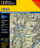
Trails Illustrated topographic maps are designed
to take you into the wilderness and back.
Printed on durable tear-resistant, waterproof
material, this map can go virtually anywhere you
do!
Click here for details. |
|
| |
|
|
|
|
Sponsors
Needed |
|
|
|
Your Ad
Can Go Here! |
|
|
|
Contact Us
Click Here
to request
Details. |
|
|
|
Multiple
Website
Advertising
Special. |
|
|
|
Buy 1 Banner
and |
|
|
|
Get Advertising
on Multiple Websites.
for one low single
ad price. |
|
|
|
| |
|