|
| |
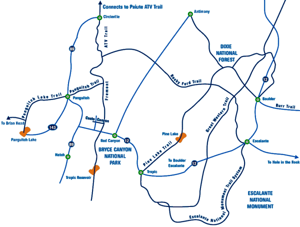
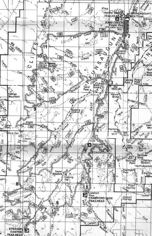
| Paunsaugunt Trail |
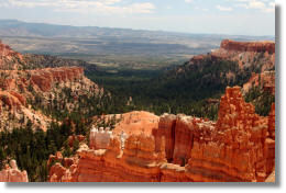 Views
of the Pink Cliffs, Grand Staircase-Escalante National Monument, and the
Kaibab Plateau in northern Arizona greet riders of the Paunsaugunt ATV Trail.
The trail begins at Tropic Reservoir and several loops from 20-75 miles
can be made. To get to the Tropic Reservoir Trailhead, turn south on the
East Fork Rd (# 087) off Highway 12. After 7 miles you will see a sign for
Tropic Reservoir and Kings Creek Campground. Turn right and continue around
the reservoir for ½ mile to the parking area and trailhead. Restrooms are
available at the trailhead. Views
of the Pink Cliffs, Grand Staircase-Escalante National Monument, and the
Kaibab Plateau in northern Arizona greet riders of the Paunsaugunt ATV Trail.
The trail begins at Tropic Reservoir and several loops from 20-75 miles
can be made. To get to the Tropic Reservoir Trailhead, turn south on the
East Fork Rd (# 087) off Highway 12. After 7 miles you will see a sign for
Tropic Reservoir and Kings Creek Campground. Turn right and continue around
the reservoir for ½ mile to the parking area and trailhead. Restrooms are
available at the trailhead.
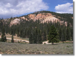
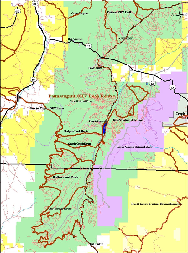
The Paunsaugunt Trail winds around the southern portion of the Paunsaugunt
Plateau on existing roads and constructed ATV trail. The main loop travels
along the edge of the Plateau with excellent views to the west and south.
Shorter loops can be made by connecting to Badger Creek, Left Fork of Blubber
Creek, or Clay Creek. The trail passes through meadows, canyons, and forests
of pine, fir, and spruce. Elevations range from 7880 feet at Tropic Reservoir
to 9200 feet at the highest point on the trail at the head of Seiler Creek.
 Sections
of the Grand View Trail are co-located with the Paunsaugunt Trail on the
west side of the Plateau. The Grand View is a foot, horse, and bike trail
so watch for signs that indicate where the Grand View and Paunsaugunt trails
separate. Sections
of the Grand View Trail are co-located with the Paunsaugunt Trail on the
west side of the Plateau. The Grand View is a foot, horse, and bike trail
so watch for signs that indicate where the Grand View and Paunsaugunt trails
separate.
Facilities: Camping and water at King Creek Campground - ATVs are allowed
ingress/egress only.
Fuel, food, lodging and camping are available in Panguitch along Hwy
89 and the Red Canyon Area along Hwy 12, and at
Ruby's Inn in Bryce.
|
 |
 |
|
|
|
| |
 |
|
|
| |
|
|
| |
 |
|
| |
 |
|
| |
 |
|
| |
NEW "Paiute
ATV Trail Guide Book". Page
after page of detailed information on the Paiute
ATV Trails. Photos, Maps, GPS Data for every
intersection and point of interest on the trail,
Tip and Tricks for riding the Paiute ATV Trails.
Click Here for More details. |
|
|
|
 |
|
|
|
 |
|
| |
|
|
|
|
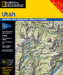
Trails Illustrated topographic maps are designed
to take you into the wilderness and back.
Printed on durable tear-resistant, waterproof
material, this map can go virtually anywhere you
do!
Click here for details. |
|
| |
|
|
|
|
Sponsors
Needed |
|
|
|
Your Ad
Can Go Here! |
|
|
|
Contact Us
Click Here
to request
Details. |
|
|
|
Multiple
Website
Advertising
Special. |
|
|
|
Buy 1 Banner
and |
|
|
|
Get Advertising
on Multiple Websites.
for one low single
ad price. |
|
|
|
| |
|