|
| |

The eastern leg out of Marysvale is quite different from the western
one. Instead of starting to rise straight out of town, the trail first descends
to the Sevier River. After crossing this river, the trail heads northward
across the Sevier's floodplain, which is lush green farm land. As the trail
rises out of the floodplain it turns about 150 degrees and heads southward
toward the mouth of Dry Creek. There are numerous uranium mines in this
area that were active in the 1940s and 1950s. In fact, with gold and silver
in the first part of the century and uranium in the middle part, Marysvale's
history is closely tied to the mining of its surrounding mountains.
From the southward turn to the mouth of Dry Creek Can yon the road crosses
a gently rolling sagebrush plain. The road is generally smooth with good
sight distances, but never-the-less requires caution. Entering Dry Fork
Canyon the character of the road changes dramatically; the canyon is very
narrow, the road rough, and sight distances are short. From the sagebrush
the road rapidly enters the riparian vegetation of cottonwood and willow
while the hillsides go from pinyon and juniper to spruce and fir. Openings
in the vegetation provide spectacular views of volcanic cliffs rising on
both sides of the canyon. When the trail suddenly breaks out into more gentle
topography this leg of the Marysvale Loop joins the main Paiute Trail.
continued next page
|
| |
 |
|
|
| |
|
|
| |
 |
|
| |
 |
|
| |
 |
|
| |
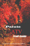
NEW "Paiute
ATV Trail Guide Book". Page
after page of detailed information on the Paiute
ATV Trails. Photos, Maps, GPS Data for every
intersection and point of interest on the trail,
Tip and Tricks for riding the Paiute ATV Trails.
Click Here for More details. |
|
|
|
 |
|
|
|
 |
|
| |
|
|
|
|
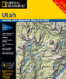
Trails Illustrated topographic maps are designed
to take you into the wilderness and back.
Printed on durable tear-resistant, waterproof
material, this map can go virtually anywhere you
do!
Click here for details. |
|
| |
|
|
|
|
Sponsors
Needed |
|
|
|
Your Ad
Can Go Here! |
|
|
|
Contact Us
Click Here
to request
Details. |
|
|
|
Multiple
Website
Advertising
Special. |
|
|
|
Buy 1 Banner
and |
|
|
|
Get Advertising
on Multiple Websites.
for one low single
ad price. |
|
|
|
| |
|