|
| |
|

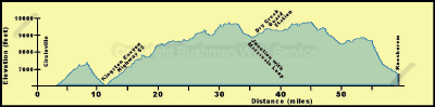
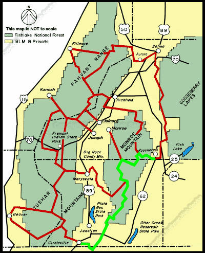
Circleville to Koosharem
The ride from Circleville to Koosharem takes about five hours. Intermediate
times for this portion of the trail are as follows:
Approximate Section Time
· Circleville to Kingston Canyon ---------------------- 1
hr
· Kingston Canyon to Dry Creek Guard Station -- 2 hrs
· Dry Creek Guard Station to Koosharem ---------- 2 hrs
Starting at the 6,000 foot elevation at Circleville the
trail rises to about 7,500 feet along the northwest slopes of Mount Dutton
before descending to 6,170 feet in Kingston Canyon. From there it rises
to nearly 10,0Starting at the 6,000 foot elevation at Circleville the trail
rises to about 7,500 feet along the northwest slopes of Mount Dutton before
descending to 6,170 feet in Kingston Canyon. From there it rises to nearly
10,000 feet near Langdon Mountain then descends to about the 6,950 foot
level in Koosharem.
The first portion of this segment of the trail, between
Circleville and Kingston Canyon of the East Fork of the Sevier River, can
be hot in summer. The trail leaving Circleville passes across the flat floor
of Circle Valley. The fields on either side of the trail are irrigated:
alfalfa is the principal crop. Potatoes used to be the principal crop of
the valley and scattered potato cellars can still be seen.rds a sweeping
panorAcross the canal the land becomes dry sage flats and begins to rise.
After climbing the rocky foothills of Mount Dutton (Table Mountain) for
a few miles, the trail breaks out onto a ridge that affords a sweeping panorama
of Circle Valley below.
continued next page
|
| |
 |
|
|
| |
|
|
| |
 |
|
| |
 |
|
| |
 |
|
| |
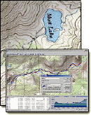
NEW "Paiute
ATV Trail Guide Book". Page
after page of detailed information on the Paiute
ATV Trails. Photos, Maps, GPS Data for every
intersection and point of interest on the trail,
Tip and Tricks for riding the Paiute ATV Trails.
Click Here for More details. |
|
|
|
 |
|
|
|
 |
|
| |
|
|
|
|
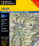
Trails Illustrated topographic maps are designed
to take you into the wilderness and back.
Printed on durable tear-resistant, waterproof
material, this map can go virtually anywhere you
do!
Click here for details. |
|
| |
|
|
|
|
Sponsors
Needed |
|
|
|
Your Ad
Can Go Here! |
|
|
|
Contact Us
Click Here
to request
Details. |
|
|
|
Multiple
Website
Advertising
Special. |
|
|
|
Buy 1 Banner
and |
|
|
|
Get Advertising
on Multiple Websites.
for one low single
ad price. |
|
|
|
| |
|