|
| |
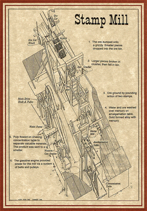
| One of the most impressive
reminders of the vitality and industry that once thrived in Bullion
City is the Bully Boy Mill. Constructed in 1922, the mill received
raw ore from the Wedge, Dalton, Great Western, Deseret, Cascade, Shamrock
and Morning Star mines. The ruins of the mill measure over 238
feet long and 45 feet wide.
The mill was a technological wonder for the time. Ore came
to the mill in mine cars which dumped their loads at the top of the
building.
As ore moved downhill through the mill, it was mechanically ground
into sand by crushers and stamps. Water was added to the crushed
ore and the slurry mixture was moved to "concentrators" where vibrating
machines separated the gold bearing ore from the worthless rock scrap.
The final step in milling ore involved passing the concentrated slurry
mixture over large copper plates coated with mercury. Mercury
is used because it attracts gold like a magnet attracts iron.
In 1938, the mill closed because the cost of milling an ounce of
gold exceeded the market value for an ounce of gold.
Today, the Bully Boy Mill is privately owned by Fehrprop Inc.
Please respect their property.
DO NOT ENTER THE
MILL.
IT IS UNSAFE
|
|
Stop 9 is 2.5 miles past the trailhead
Next Page [ Stop 9 - Miners
Park Historical Trail ]
|
 |
|
|
Stop 9 is 2.5 miles past the trailhead
Next Page [ Stop 9 - Miners
Park Historical Trail ]
|
|
|
| |
| |
 |
|
|
| |
|
|
| |
 |
|
| |
 |
|
| |
 |
|
| |
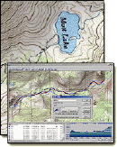
NEW "Paiute
ATV Trail Guide Book". Page
after page of detailed information on the Paiute
ATV Trails. Photos, Maps, GPS Data for every
intersection and point of interest on the trail,
Tip and Tricks for riding the Paiute ATV Trails.
Click Here for More details. |
|
|
|
 |
|
|
|
 |
|
| |
|
|
|
|
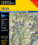
Trails Illustrated topographic maps are designed
to take you into the wilderness and back.
Printed on durable tear-resistant, waterproof
material, this map can go virtually anywhere you
do!
Click here for details. |
|
| |
|
|
|
|
Sponsors
Needed |
|
|
|
Your Ad
Can Go Here! |
|
|
|
Contact Us
Click Here
to request
Details. |
|
|
|
Multiple
Website
Advertising
Special. |
|
|
|
Buy 1 Banner
and |
|
|
|
Get Advertising
on Multiple Websites.
for one low single
ad price. |
|
|
|
| |
|