|
| |
 At
this stop, you can look across the bridge and upstream to the site of
what was once the center of Bullion City. During it's heyday,
the camp had dozens of buildings and over a thousand inhabitants on
both sides of the creek. The 1881 census shows the pop. of the
town as 1,651 souls but 10 years later, this figure had declined to
259. At
this stop, you can look across the bridge and upstream to the site of
what was once the center of Bullion City. During it's heyday,
the camp had dozens of buildings and over a thousand inhabitants on
both sides of the creek. The 1881 census shows the pop. of the
town as 1,651 souls but 10 years later, this figure had declined to
259.
Life in gold camps like Bullion City was hard. Health conditions
were poor and often there was no medicine. Lodgings were primitive,
most miners lived in tents or crude shelters with walls of canvas, hides
or rough-hewn planks. Mining for gold was hard, monotonous labor.
It was frequently necessary to work long hours while knee-deep in mud
or icy water. Mining laborers generally worked 10 hour shifts,
6 days a week with Saturdays off.
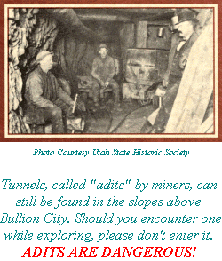
Mining camps could also be dangerous places. Consider
this account from a nearby mining camp by Merril Utley in The Ghosts
of Gold Mountain 1992:
[Two miners by the names of R.J. Gibson and
J. Jacobs] had been imbibing rather freely of the flowering bowl and
got into a dispute over a gold claim... they mutually agreed to retire
to the street and settle their differences... As they got into the street,
they began pumping away at each other [with pistols] only a few feet
apart. (They both missed).
Fire was another danger and could easily devastate a
town made of wood and canvas. It is said that a fire storm raged
up the dirt road by the bridge on the right side of the creek (north)
destroying a number of shacks and cabins. Look across the bridge and
up the north-facing slopes of the canyon. As you drive up the
road beneath these slopes, look for islands of aspen surrounded by spruce
and fir trees. These aspen trees, recognized by their light green
leaves in summer, are what grew back after a 1923 fire that started
at a mine.
|
|
|
Stop 7 is 2.2 miles past the trailhead
Next Page [ Stop 7 -
Gibbs Cabin Site ]
|
|
|
|
|
| |
 |
|
|
| |
|
|
| |
 |
|
| |
 |
|
| |
 |
|
| |
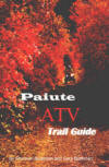
NEW "Paiute
ATV Trail Guide Book". Page
after page of detailed information on the Paiute
ATV Trails. Photos, Maps, GPS Data for every
intersection and point of interest on the trail,
Tip and Tricks for riding the Paiute ATV Trails.
Click Here for More details. |
|
|
|
 |
|
|
|
 |
|
| |
|
|
|
|
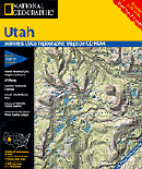
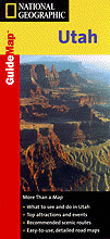
Trails Illustrated topographic maps are designed
to take you into the wilderness and back.
Printed on durable tear-resistant, waterproof
material, this map can go virtually anywhere you
do!
Click here for details. |
|
| |
|
|
|
|
Sponsors
Needed |
|
|
|
Your Ad
Can Go Here! |
|
|
|
Contact Us
Click Here
to request
Details. |
|
|
|
Multiple
Website
Advertising
Special. |
|
|
|
Buy 1 Banner
and |
|
|
|
Get Advertising
on Multiple Websites.
for one low single
ad price. |
|
|
|
| |
|