 From
the traffic turnout, a narrow trail leads down the bank towards the
stream. On the very edge of the creek and partially in the water
there is a large block of stone about 10 feet long. A circular
depression 34 inches in diameter has been cut into the top of the stone.
According to local lore, the first American miners to enter Bullion
Canyon in the 1860's found rotted sacks of ore against this boulder.
Perhaps earlier miners had milled high grade ore on this device which
is called an arrastra.
Arrastras were first introduced into the New World by the Spanish
in the 1500's. To use the arrastra, ore was broken into walnut-sized
chunks with a sledge hammer and placed into the circular milling area.
Three drag stones, chained to a post in the center of the milling area,
were rotated by hand or mule. The drag stones crushed the ore
into a fine powder and water was added until a thick slurry was produced.
Mercury (quicksilver) was then introduced to the mixture which removed
and amalgamated any gold found in the ore.
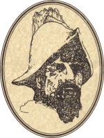
Does the presence of this arrastra tell us that Spanish Conquistadors
were in this canyon mining gold two or three hundred years ago?
The answer is neither a simple yes or no because archeologists have
no way to "date" the arrastra.
If we turn to written history for a clue, we are told that the Spanish
were insatiable in their quest for riches. During the 1600's and
1700's this appetite had driven them to explore most of what was to
become the southern half of the United States.
Because they had established a nearby stronghold in New Mexico (1598),
it is possible that there were Conquistadors in Utah and maybe even
in Bullion Canyon long before the first "official" expedition by the
Spanish in 1776.