Utah
Page two
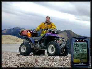
On the Mt. Belknap ridge! This the highest point of my travels.
My third day there I found this high peak, and was drawn to it repeatedly
over my stay. The view was awesome in spite of the smoke from the forest
f On the Mt. Belknap ridge! This the highest point of my travels.
My third day there I found this high peak, and was drawn to it repeatedly
over my stay. The view was awesome in spite of the smoke from the forest
fires on the West Coast. I came up here several times - once I even saw
mountain goats in the distance (through binoculars). They kept far from
roads and trails; indeed they kept to some pretty treacherous territory
from what I could see. There were still patches of snow on some of the surrounding
mountains. I did find it somewhat hard to breath, being a pudgy lowlander.
Marysvale is pretty high up though, over a 5870 feet, so I acclimated fairly
quickly I think. My GPS said I was over 11,700 feet high here, which is
the highest I think I've ever been without being in an aircraft. I was surprised
that my quads (which had not been re-jetted) ran this high without a problem.
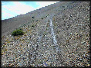
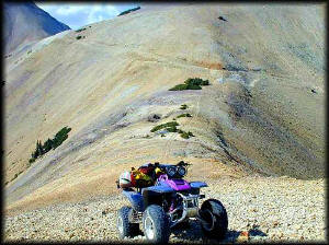
This is the trail up to the Mt. Belknap
ridge. The first few times were scary because the shale/scree was so loose.
I did have problems with the fact that the chain ring hangs kind of low
on the Warrior, and you don't have much clearance. This trail, like many
that only had ATV traffic on them, had a high center and two ruts from the
wheels of other quads. This meant that the center of the track often collided
with the guard covering the chain ring, so I started riding to the side
of the trail a bit. This let the chain ring would hang into a wheel rut
of the trail rather than colliding with every bump. This was happier for
the chain ring guard, but sometimes meant I was on the "edge" of a precipitous
drop.
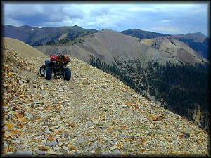
This is precipitous, but well traveled
and fairly wide. I would venture to say that, for reasons unknown to me,
a dozer cleared this trail up this part of the mountain. Why I'm not sure,
but I was happy to be able to ride it! I flung some rocks down the mountain,
rolling them on edge like a Frisbee on it's side, and they rolled until
I literally couldn't see them any more. There seemed no end to the bottom
of some of the mountains here.
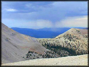
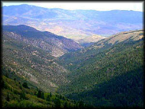
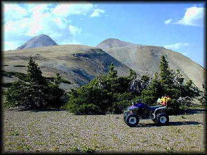
This is looking to the northeast from the top, or at least the highest
point I was able to climb next to Mt. Belknap. You can see the rain falling
about 25 miles away, probably right over the I-70 west of Richfield. Those
trails you can see on the ridge across from me led to more of the same type
of riding that it took to get on this ridge. On the other side of that hill
about 10 miles distant lies Kimberley, an all but gone ghost town.
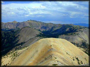
This is looking south from my vantage
point. You can still see faint patches of snow on the hills in the distance.
The day before I arrived it snowed, but most of it was gone by the time
I found my way up to these mountains. In spite of the overcast that was
about me intermittently through my stay, I never got rained on very hard.
I did ride into areas that had had some brief thunderstorm activity; evident
from the roaring muddy white-water creeks I rode past (not through). A couple
times I was scared off the high trails due to lightning activity, but never
had any real close calls. A few days later, from this same spot, I spied
a herd of about 30 mountain goats on those hills with binoculars, but could
never get close to them.
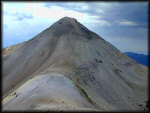
This is Mt. Belknap proper. Its elevation is
12,173 elevation. Incredibly, from the ridge I'm on (at 11,710') there was
a faint foot trail down, across the saddle, and up the side of the Mount
to the top. I studied it closely with binoculars, and I could see a cross
on the pinnacle. The trail up the side of the mount looked scarier than
hell, since it was much steeper than one I was one. One misstep,
and your ass would be a goner. I considered riding down the slope and over
to the base, but there was no trail (or, nobody else had tried it) that
I could see. That and the brief thought of my bones bleaching in the sun
at the base of this thing made me cancel the idea altogether.
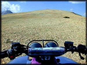
One day I found this little trail across
to another ridge. The Warrior chugged right up it. The trail more or less
evaporated at the top, since the rock wasn't so loose and no tracks were
discernible. The top was rounded, like the top of a marble, so I couldn't
see "over the edge". I got off and walked for a ways, and discovered I could
ride right on over the top of the "marble" onto another ridge. I hiked back
to the quad, and continued on over. It was pretty steep, but not bad as
long as I stayed on the "spine" of the ridge. I wondered if I would be able
to get back up. Too late - I was committed.
The other side was pretty neat. I explored
the whole ridge, and found several areas that looked promising, but didn't
have a discernible trail to get me down. I found a couple of fire rings,
but other than that the area was barren of any sign of mankind (the way
it should be). I decided the only safe way out was the way I'd come in,
and went back. You can see Belknap in the rear left.
Yep, it was steep. Funny, going down wasn't
a problem! The picture is somewhat deceiving, as it really seemed to climb
to near vertical. I came down it fine, but worried that the altitude would
rob so much power that I wouldn't be able to get back over this hill to
the other side. I made it, though this was one of the more challenging areas
for me to get out of. The rock here wasn't as loose, and the quad left absolutely
no trace of its presence behind me.
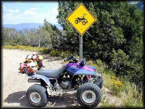
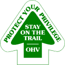
Back on the main Paiute trail - and this is my kinda sign! Too bad California
doesn't have any like this. It makes me sad to see so much of the OHV riding
area being taken away from Californians, however I can honestly say that
too many of the OHV riders in California are destructive hellions. One need
only look as far as
Glamis nowadays to see how trashed it has become.